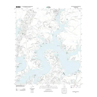
2013 Map of Mansfield Dam
USGS Topo · Published 2013About this map
Lake Travis dominates this central Texas landscape, where the winding course of the Colorado River has created a complex shoreline of deep inlets and prominent peninsulas. The residential expansion of the early 21st century is evident in the dense street networks of Lago Vista and Jonestown, contrasting with the more dispersed settlements of North Shore Acres and Hudson Bend. This era shows the area as a developed recreation and residential hub, anchored by the Lago Vista - TX - Rusty Allen Airport.
Find a feature on this map
46 named features on this map. Tap any name to fly to it.
Don’t see what you’re looking for? This feature index may not catch every label — zoom into the map to look around manually.
Map Details
Editions of this 2013 Mansfield Dam Map
This is the sole edition of this map. No revisions or reprints were ever made.
Other maps of this area

1887 · Blanco
USGS Topo · 1:125,000

1887 · Burnet
USGS Topo · 1:125,000

1893 · Georgetown
USGS Topo · 1:125,000

1893 · Burnet
USGS Topo · 1:125,000

1894 · Blanco
USGS Topo · 1:125,000

1896 · Austin
USGS Topo · 1:125,000

1897 · Austin
USGS Topo · 1:125,000

1903 · Burnet
USGS Topo · 1:125,000

1909 · Burnet
USGS Topo · 1:125,000

1910 · Austin
USGS Topo · 1:125,000