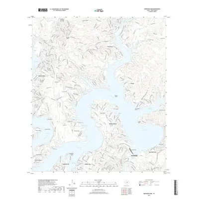
2019 Map of Mansfield Dam
USGS Topo · Published 2019About this map
Mansfield Dam controls the waters of the Colorado River at the southern edge of this 2019 survey, forming the extensive reach of Lake Travis and Lake Austin below. The terrain is characterized by deep incisions like Defeat Hollow and Collier Hollow, which define the residential expansion of communities such as Lakeway and Lago Vista. Local history is anchored by the Simpson Cem near Arkansas Bend and the Teck Cem further south. The map illustrates the complex shoreline of the Highland Lakes, where peninsulas like Hudson Bend and Graveyard Point are surrounded by various inlets including Hatter Cove and Cunningham Cove. Elevations rise sharply at Post Oak Ridge and Bald Mtn, overlooking the many arms and bends that have come to define this central Texas landscape.
Find a feature on this map
55 named features on this map. Tap any name to fly to it.
Don’t see what you’re looking for? This feature index may not catch every label — zoom into the map to look around manually.
Map Details
Editions of this 2019 Mansfield Dam Map
This is the sole edition of this map. No revisions or reprints were ever made.
Other maps of this area

1887 · Blanco
USGS Topo · 1:125,000

1887 · Burnet
USGS Topo · 1:125,000

1893 · Georgetown
USGS Topo · 1:125,000

1893 · Burnet
USGS Topo · 1:125,000

1894 · Blanco
USGS Topo · 1:125,000

1896 · Austin
USGS Topo · 1:125,000

1897 · Austin
USGS Topo · 1:125,000

1903 · Burnet
USGS Topo · 1:125,000

1909 · Burnet
USGS Topo · 1:125,000

1910 · Austin
USGS Topo · 1:125,000