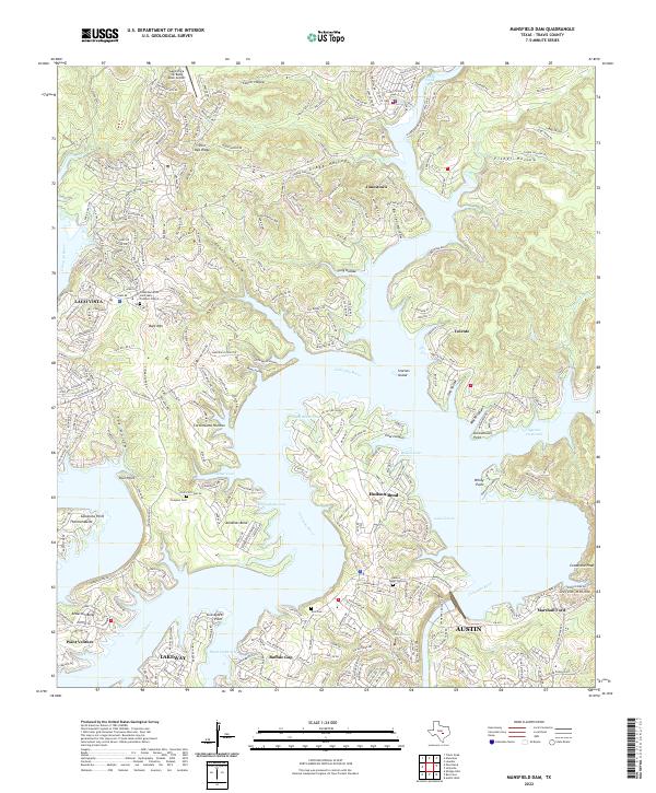
2022 Map of Mansfield Dam
USGS Topo · Published 2022About this map
The Colorado River dominates this modern topographical study, carving a complex sequence of peninsulas and deep inlets including the Sandy Creek Arm and Cypress Creek Arm. The landscape is characterized by high-density residential development along the shoreline, where established communities like Lago Vista, Jonestown, and Lakeway have shaped the limestone hills of Travis County. Smaller enclaves such as Point Venture, Hudson Bend, and Volente are situated along the water's edge, highlighting the post-war suburban transformation of the Texas Hill Country.
Find a feature on this map
47 named features on this map. Tap any name to fly to it.
Don’t see what you’re looking for? This feature index may not catch every label — zoom into the map to look around manually.
Map Details
Editions of this 2022 Mansfield Dam Map
This is the sole edition of this map. No revisions or reprints were ever made.
Other maps of this area

1887 · Blanco
USGS Topo · 1:125,000

1887 · Burnet
USGS Topo · 1:125,000

1893 · Georgetown
USGS Topo · 1:125,000

1893 · Burnet
USGS Topo · 1:125,000

1894 · Blanco
USGS Topo · 1:125,000

1896 · Austin
USGS Topo · 1:125,000

1897 · Austin
USGS Topo · 1:125,000
1903 · Burnet
USGS Topo · 1:125,000
1909 · Burnet
USGS Topo · 1:125,000

1910 · Austin
USGS Topo · 1:125,000