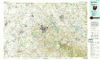
1994 Map of Mansfield
USGS Topo · Published 1994About this map
Mansfield and Ashland anchor this mid-1990s landscape, which illustrates the complex water systems of the Mohican River and its various forks. The map reveals a region defined by substantial conservation and recreational land, including the famous Malabar Farm State Park and the expansive Mohican State Forest and Park. These public lands sit alongside major reservoirs like Charles Mill Lake and Pleasant Hill Lake, which manage the drainage of the Black Fork Mohican River and Clear Fork Mohican River.
Find a feature on this map
225 named features on this map. Tap any name to fly to it.
Don’t see what you’re looking for? This feature index may not catch every label — zoom into the map to look around manually.
Map Details
Editions of this 1994 Mansfield Map
This is the sole edition of this map. No revisions or reprints were ever made.
Other maps of this area

1901 · Wooster
USGS Topo · 1:62,500

1903 · Wooster
USGS Topo · 1:62,500

1903 · Marion
USGS Topo · 1:62,500

1904 · Medina
USGS Topo · 1:62,500

1904 · Wellington
USGS Topo · 1:62,500

1905 · Marion
USGS Topo · 1:62,500

1906 · Sycamore
USGS Topo · 1:62,500

1906 · Medina
USGS Topo · 1:62,500

1906 · Wellington
USGS Topo · 1:62,500

1906 · Tiffin
USGS Topo · 1:62,500