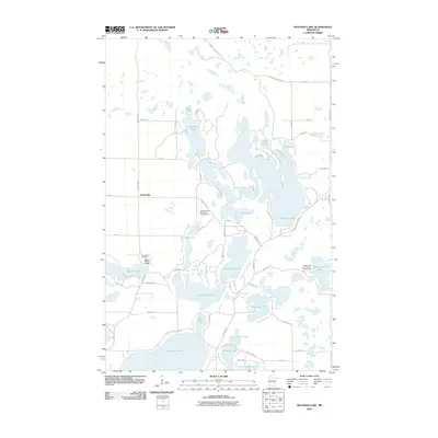
2010 Map of Mantrap Lake
USGS Topo · Published 2010About this map
Glacial lake basins dominate this Hubbard County landscape, where the irregularly shaped Mantrap Lake and Big Sand Lake form the core of a dense aquatic network. The settlement of Emmaville sits at the junction of County Hwy-4 and County Hwy-24, serving as a central point between numerous smaller water bodies like Bad Axe Lake, Stocking Lake, and the connected Upper Bottle Lake and Lower Bottle Lake. This area shows a clear pattern of seasonal and residential growth centered on water access, evidenced by clusters of roads like Island View Dr and Inspiration Dr. Cultural and recreational markers are interspersed throughout the woods and shorelines, including the Lake Emma Cemetery near Deer Lane and dedicated vacation spots such as Sleeping Fawn Resort and Campground and Jemstar Lake and Woods Campground. The road network, including Karmal Forest Rd in the north, indicates a landscape managed for both timber and recreation.
Find a feature on this map
58 named features on this map. Tap any name to fly to it.
Don’t see what you’re looking for? This feature index may not catch every label — zoom into the map to look around manually.
Map Details
Editions of this 2010 Mantrap Lake Map
This is the sole edition of this map. No revisions or reprints were ever made.
Other maps of this area

1953 · Brainerd
USGS Topo · 1:250,000

1954 · Bemidji
USGS Topo · 1:250,000

1957 · Brainerd
USGS Topo · 1:250,000

1957 · Bemidji
USGS Topo · 1:250,000

1958 · Bemidji
USGS Topo · 1:250,000

1958 · Brainerd
USGS Topo · 1:250,000

1965 · Brainerd
USGS Topo · 1:250,000

1969 · Park Rapids
USGS Topo · 1:24,000

1970 · Nevis
USGS Topo · 1:24,000

1970 · Dorset
USGS Topo · 1:24,000