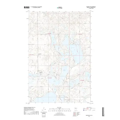
2019 Map of Mantrap Lake
USGS Topo · Published 2019About this map
Mantrap Lake and its surrounding glacial basin define this landscape in Hubbard County, where a dense network of water bodies has historically shaped local settlement and recreation. Small communities like Emmaville and Deer Lane are positioned near the chain of lakes, which includes the interconnected Upper Bottle Lake and Lower Bottle Lake. The map reveals a transition from these large lakes to smaller, isolated ones such as Buck Lake and Mud Lake, often linked by secondary routes like Campground Rd and Skunk Lake Rd. This 2019 survey documents the modern layout of residential parcels and local infrastructure, such as the Lake Emma Cem, providing a detailed record for genealogists and local historians tracking the development of this lake country. The distribution of wetlands and the irregular shoreline of Big Sand Lake suggest a landscape where transportation and home sites are intimately tied to the water's edge.
Find a feature on this map
86 named features on this map. Tap any name to fly to it.
Don’t see what you’re looking for? This feature index may not catch every label — zoom into the map to look around manually.
Map Details
Editions of this 2019 Mantrap Lake Map
This is the sole edition of this map. No revisions or reprints were ever made.
Other maps of this area

1953 · Brainerd
USGS Topo · 1:250,000

1954 · Bemidji
USGS Topo · 1:250,000

1957 · Brainerd
USGS Topo · 1:250,000

1957 · Bemidji
USGS Topo · 1:250,000

1958 · Bemidji
USGS Topo · 1:250,000

1958 · Brainerd
USGS Topo · 1:250,000

1965 · Brainerd
USGS Topo · 1:250,000

1969 · Park Rapids
USGS Topo · 1:24,000

1970 · Nevis
USGS Topo · 1:24,000

1970 · Dorset
USGS Topo · 1:24,000