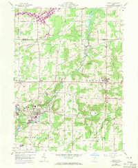
1959 Map of Mantua
USGS Topo · Published 1971About this map
The Cuyahoga River winds through the heart of this Portage County landscape, connecting the industrial and academic hubs of Mantua and Hiram. While Hiram College anchors the eastern heights, the river valley below reflects a mid-century infrastructure in transition, marked by the presence of the Erie-Lackawanna railroad and the La Due Reservoir spillway in the northwest.
Find a feature on this map
44 named features on this map. Tap any name to fly to it.
Don’t see what you’re looking for? This feature index may not catch every label — zoom into the map to look around manually.
Map Details
Editions of this 1959 Mantua Map
3 editions found
Other maps of this area

1905 · Garrettsville
USGS Topo · 1:62,500

1906 · Kent
USGS Topo · 1:62,500

1906 · Chagrin Falls
USGS Topo · 1:62,500

1906 · Ravenna
USGS Topo · 1:62,500

1907 · Garrettsville
USGS Topo · 1:62,500

1908 · Chagrin Falls
USGS Topo · 1:62,500

1908 · Ravenna
USGS Topo · 1:62,500

1950 · Cleveland
USGS Topo · 1:250,000

1953 · South Russell
USGS Topo · 1:24,000

1953 · Aurora
USGS Topo · 1:24,000