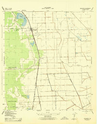
1956 Map of Manvel
USGS Topo · Published 1970About this map
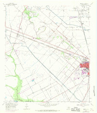
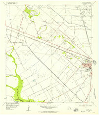
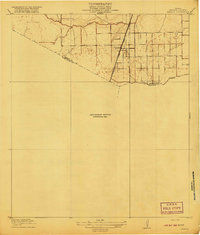
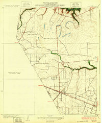
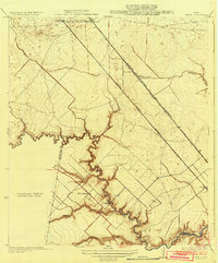
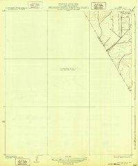
Mustang Bayou and Chigger Creek meander across this low coastal prairie, where the industrial presence of the Hastings Oil Field dominates the northern landscape. The mid-century development of Alvin and Manvel is clearly defined, showing the expansion of residential blocks in purple updates from 1969. Transportation and infrastructure are central to the area's identity, anchored by the Atchison Topeka and Santa Fe railroad line and an extensive network of drainage features like the Briscoe Canal and numerous elevated ditches.
Find a feature on this map
26 named features on this map. Tap any name to fly to it.
Don’t see what you’re looking for? This feature index may not catch every label — zoom into the map to look around manually.
Map Details
Editions of this 1956 Manvel Map
2 editions found
Other maps of this area
1916 · Genoa
USGS Topo · 1:24,000

1920 · Genoa
USGS Topo · 1:31,680
1920 · Mykawa
USGS Topo · 1:31,680
1920 · Almeda
USGS Topo · 1:31,680

1929 · Algoa
USGS Topo · 1:24,000
1932 · Algoa
USGS Topo · 1:31,680
1932 · Genoa
USGS Topo · 1:31,680
1932 · Mustang Bayou
USGS Topo · 1:31,680
1943 · Rosharon
USGS Topo · 1:31,680
1943 · Mustang Bayou
USGS Topo · 1:31,680