
1953 Map of Maple Hill
USGS Topo · Published 1954About this map
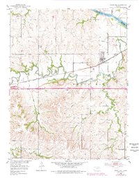
Mill Creek winds through the heart of Wabaunsee County, creating a deeply eroded valley that defines the local geography. The town of Maple Hill serves as the primary hub, situated just north of the creek and the Chicago Rock Island and Pacific railroad line. To the west, the small settlement of Vera marks another point along this vital transportation corridor. The contrast between the broad floodplains of the Kansas River in the northeast corner and the dissected uplands to the south is striking, highlighted by landmarks like Buffalo Mound. Local life in the early 1950s is anchored by rural institutions such as Maple Hill Ch and Sunny Side Sch, while the presence of a Mine and various creek crossings like Turkey Creek and Snokomo Creek point to the area's agricultural and resource-based economy. The map also clearly delineates the Shawnee and Wabaunsee County boundary as it follows the river's course.
Find a feature on this map
17 named features on this map. Tap any name to fly to it.
Don’t see what you’re looking for? This feature index may not catch every label — zoom into the map to look around manually.
Map Details
Editions of this 1953 Maple Hill Map
2 editions found
Other maps of this area

1885 · Eskridge
USGS Topo · 1:125,000

1889 · Burlingame
USGS Topo · 1:125,000

1889 · Wamego
USGS Topo · 1:125,000

1889 · Eskridge
USGS Topo · 1:125,000

1889 · Topeka
USGS Topo · 1:125,000

1894 · Eskridge
USGS Topo · 1:125,000

1894 · Burlingame
USGS Topo · 1:125,000

1894 · Topeka
USGS Topo · 1:125,000

1894 · Wamego
USGS Topo · 1:125,000

1947 · Lawrence
USGS Topo · 1:250,000