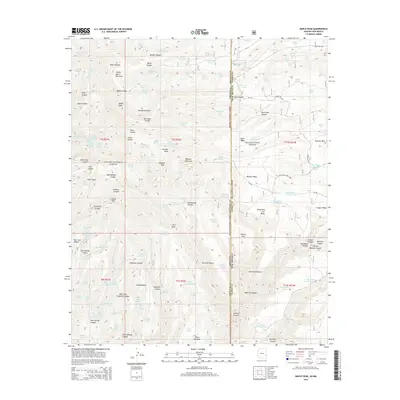
2014 Map of Maple Peak
USGS Topo · Published 2014About this map
Maple Peak rises as a central landmark in this high-altitude borderland between Arizona and New Mexico. The landscape is defined by the intersection of the Apache National Forest and the Gila National Forest, where steep drainages like Hobo Canyon and Buzzard Canyon carve through the high plateaus. The distribution of livestock water sources, such as Hobo Number Three Tank and Liza Tank, points to the region's historical reliance on seasonal grazing. Higher elevations are marked by prominent summits including Charlie Moore Mountain and Webster Mountain. The map reveals a complex system of remote mesas, notably Smoothing Iron Mesa and J Lazy H Mesa, accessible only by rugged forest routes like Smoothing Iron Rd. This 2014 survey documents the enduring ranching infrastructure and wilderness boundaries of the eastern Gila wilderness area.
Find a feature on this map
153 named features on this map. Tap any name to fly to it.
Don’t see what you’re looking for? This feature index may not catch every label — zoom into the map to look around manually.
Map Details
Editions of this 2014 Maple Peak Map
This is the sole edition of this map. No revisions or reprints were ever made.
Other maps of this area

1910 · Mogollon
USGS Topo · 1:125,000

1912 · Mogollon
USGS Topo · 1:125,000

1913 · Morenci
USGS Topo · 1:125,000

1915 · Morenci
USGS Topo · 1:125,000

1954 · Clifton
USGS Topo · 1:250,000

1957 · Clifton
USGS Topo · 1:250,000

1958 · Clifton
USGS Topo · 1:250,000

1962 · Clifton
USGS Topo · 1:250,000

1962 · Big Lue Mts
USGS Topo · 1:62,500
1963 · Alma
USGS Topo · 1:24,000