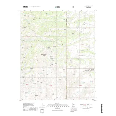
2018 Map of Maple Peak
USGS Topo · Published 2018About this map
Maple Peak and Bullard Peak dominate this rugged high-altitude landscape along the border of Apache National Forest and Gila National Forest. The 2018 survey reveals a terrain defined by a complex network of canyons and mesas, including Coalton Mesa and the Sierra Aguilada. Water management is the primary sign of human modification in this remote area, evidenced by a dense distribution of named stock tanks such as Maple Peak Tank, One Horn Tank, and Citizen Tank. The presence of these tanks alongside features like the Charlie Moore Trail and Buchanan Tank Trail suggests a landscape utilized for seasonal grazing and forest management. The map also documents the interstate boundary between Arizona and New Mexico, crossing through Devils Den Canyon and near the summit of Webster Mtn.
Find a feature on this map
153 named features on this map. Tap any name to fly to it.
Don’t see what you’re looking for? This feature index may not catch every label — zoom into the map to look around manually.
Map Details
Editions of this 2018 Maple Peak Map
This is the sole edition of this map. No revisions or reprints were ever made.
Other maps of this area

1910 · Mogollon
USGS Topo · 1:125,000

1912 · Mogollon
USGS Topo · 1:125,000

1913 · Morenci
USGS Topo · 1:125,000

1915 · Morenci
USGS Topo · 1:125,000

1954 · Clifton
USGS Topo · 1:250,000

1957 · Clifton
USGS Topo · 1:250,000

1958 · Clifton
USGS Topo · 1:250,000

1962 · Clifton
USGS Topo · 1:250,000

1962 · Big Lue Mts
USGS Topo · 1:62,500
1963 · Alma
USGS Topo · 1:24,000