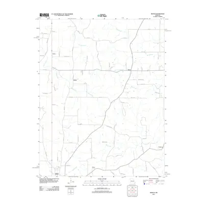
2011 Map of Maples
USGS Topo · Published 2011About this map
Licking sits at the southern edge of this landscape, serving as a primary point of navigation for the surrounding rural communities of Maples, Kimble, and Coulstone. The area is defined by its network of watercourses, including the north-flowing Little Piney Creek and Sherrill Creek, which create a complex drainage pattern across the region. Several family-named burial grounds, such as Hutchison Cemetery, Concord Cemetery, White Cemetery, and Williams Cemetery, are scattered along the rural road network, providing important markers for local genealogical research. The road system is dominated by local routes like Co Road CC, Kimble Rd, and Phelps Rd, which connect the disparate farmsteads and small settlements. The topography is further etched by smaller tributaries like Kissock Creek, Pigeon Creek, and Sample Creek, showing a terrain where land use is dictated by the proximity to these local water sources.
Find a feature on this map
60 named features on this map. Tap any name to fly to it.
Don’t see what you’re looking for? This feature index may not catch every label — zoom into the map to look around manually.
Map Details
Editions of this 2011 Maples Map
This is the sole edition of this map. No revisions or reprints were ever made.
Other maps of this area

1932 · Cedar Grove
USGS Topo · 1:48,000

1937 · Edgar Springs
USGS Topo · 1:48,000

1941 · Salem
USGS Topo · 1:62,500

1945 · Salem
USGS Topo · 1:62,500

1945 · Edgar Springs
USGS Topo · 1:62,500

1949 · Rolla
USGS Topo · 1:250,000

1951 · Montauk
USGS Topo · 1:24,000

1951 · Licking
USGS Topo · 1:24,000

1951 · Prescott
USGS Topo · 1:24,000

1951 · Raymondville
USGS Topo · 1:62,500