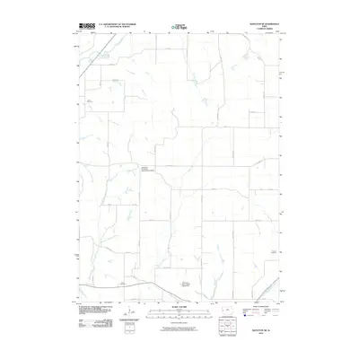
2010 Map of Mapleton SE
USGS Topo · Published 2010About this map
The Iowa State University Experimental Station serves as a central landmark in this agricultural corner of Monona County, illustrating the long-standing connection between regional farming and academic research. The landscape is defined by the drainage networks of the Maple River in the northwest and the Soldier River in the southeast, with numerous tributaries like McCleery Creek and Jordan Creek carving through the terrain. A grid of rural roads, including Poplar Ave and Sequoia Ave, connects scattered homesteads and local infrastructure.
Find a feature on this map
31 named features on this map. Tap any name to fly to it.
Don’t see what you’re looking for? This feature index may not catch every label — zoom into the map to look around manually.
Map Details
Editions of this 2010 Mapleton SE Map
This is the sole edition of this map. No revisions or reprints were ever made.
Other maps of this area

1954 · Omaha
USGS Topo · 1:250,000

1954 · Fort Dodge
USGS Topo · 1:250,000

1957 · Omaha
USGS Topo · 1:250,000

1957 · Fort Dodge
USGS Topo · 1:250,000

1958 · Omaha
USGS Topo · 1:250,000

1958 · Fort Dodge
USGS Topo · 1:250,000

1969 · Danbury
USGS Topo · 1:24,000

1969 · Mapleton
USGS Topo · 1:24,000

1969 · Castana
USGS Topo · 1:24,000
1969 · Smithland
USGS Topo · 1:24,000