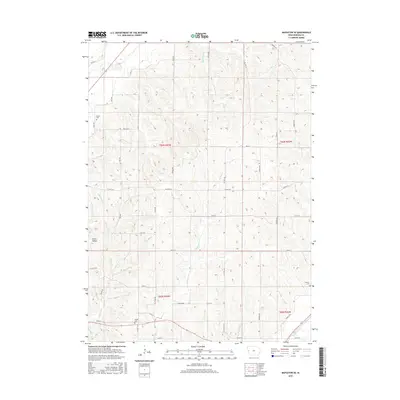
2015 Map of Mapleton SE
USGS Topo · Published 2015About this map
Green Valley and the surrounding drainage basins of Monona County define the landscape of this 2015 survey. The terrain is deeply carved by watercourses including McCleerey Cr, Jordan Cr, and Cottonwood Cr, which feed into the larger Soldier River in the south. The rural character of the region is punctuated by family and community landmarks such as Center Cem, Jordan Cem, and Putman Cem. A strict grid of section lines and county roads, including Co HWY e34 and Co HWY l32, provides structure across the township boundaries of T84N and T83N. The map illustrates the persistent agricultural and cemetery locations that have served local residents for generations, situated amidst the natural contours of western Iowa.
Find a feature on this map
34 named features on this map. Tap any name to fly to it.
Don’t see what you’re looking for? This feature index may not catch every label — zoom into the map to look around manually.
Map Details
Editions of this 2015 Mapleton SE Map
This is the sole edition of this map. No revisions or reprints were ever made.
Other maps of this area

1954 · Omaha
USGS Topo · 1:250,000

1954 · Fort Dodge
USGS Topo · 1:250,000

1957 · Omaha
USGS Topo · 1:250,000

1957 · Fort Dodge
USGS Topo · 1:250,000

1958 · Omaha
USGS Topo · 1:250,000

1958 · Fort Dodge
USGS Topo · 1:250,000

1969 · Danbury
USGS Topo · 1:24,000

1969 · Mapleton
USGS Topo · 1:24,000

1969 · Castana
USGS Topo · 1:24,000
1969 · Smithland
USGS Topo · 1:24,000