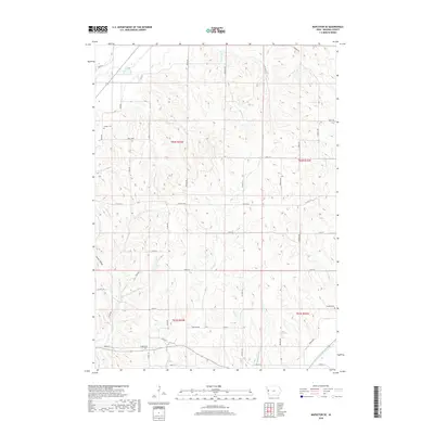
2018 Map of Mapleton SE
USGS Topo · Published 2018About this map
Soldier River anchors the southeastern corner of this Iowa landscape, where the terrain transitions from the broader valley into the dissected uplands of Monona County. The hydrology is defined by a dense network of tributaries including McCleerey Cr and Jordan Cr, which carve through the loess hills typical of this region. This 2018 survey reveals a rural infrastructure organized around the Public Land Survey System, with gravel roads like Sequoia Ave and Poplar Ave following section lines over undulating ridges.
Find a feature on this map
37 named features on this map. Tap any name to fly to it.
Don’t see what you’re looking for? This feature index may not catch every label — zoom into the map to look around manually.
Map Details
Editions of this 2018 Mapleton SE Map
This is the sole edition of this map. No revisions or reprints were ever made.
Other maps of this area

1954 · Omaha
USGS Topo · 1:250,000

1954 · Fort Dodge
USGS Topo · 1:250,000

1957 · Omaha
USGS Topo · 1:250,000

1957 · Fort Dodge
USGS Topo · 1:250,000

1958 · Omaha
USGS Topo · 1:250,000

1958 · Fort Dodge
USGS Topo · 1:250,000

1969 · Danbury
USGS Topo · 1:24,000

1969 · Mapleton
USGS Topo · 1:24,000

1969 · Castana
USGS Topo · 1:24,000
1969 · Smithland
USGS Topo · 1:24,000