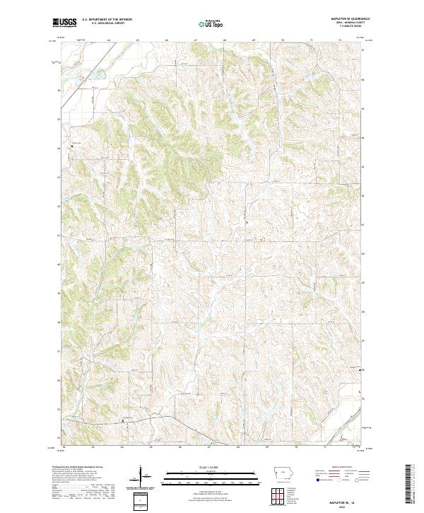
2022 Map of Mapleton SE
USGS Topo · Published 2022About this map
Soldier River and its tributary system define the drainage of this portion of Monona County, where the landscape is carved by McCleery Cr, Jordan Cr, and Cottonwood Cr. The map documents a predominantly rural section of western Iowa, structured by a strict section-line road grid with names like Plum Ave and Poplar Ave. For genealogists, the map identifies three distinct burial grounds: Center Cem in the northwest, Jordan Cem near the southern boundary, and Putman Cem on the eastern edge. The concentration of these cemeteries alongside established waterways like Beaver Cr suggests the enduring footprints of early family homesteads and pioneer-era community centers within the township boundaries of t84n r43w and t84n r42w.
Find a feature on this map
36 named features on this map. Tap any name to fly to it.
Don’t see what you’re looking for? This feature index may not catch every label — zoom into the map to look around manually.
Map Details
Editions of this 2022 Mapleton SE Map
This is the sole edition of this map. No revisions or reprints were ever made.
Other maps of this area

1954 · Omaha
USGS Topo · 1:250,000

1954 · Fort Dodge
USGS Topo · 1:250,000

1957 · Omaha
USGS Topo · 1:250,000

1957 · Fort Dodge
USGS Topo · 1:250,000

1958 · Omaha
USGS Topo · 1:250,000

1958 · Fort Dodge
USGS Topo · 1:250,000

1969 · Danbury
USGS Topo · 1:24,000

1969 · Mapleton
USGS Topo · 1:24,000

1969 · Castana
USGS Topo · 1:24,000
1969 · Smithland
USGS Topo · 1:24,000