
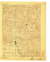
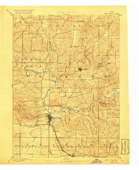
1891 Map of Maquoketa
USGS Topo · Published 1891About this map
The confluence of the North Fork Maquoketa River and the main stem of the Maquoketa River anchors this 1889 survey of eastern Iowa. The seat of Jackson County, Maquoketa, appears as a developing hub at the junction of two major rail systems: the Chicago and North Western Railroad and the Chicago Milwaukee and St. Paul Railroad. The landscape is a network of small farming townships including Richland and Perry, where settlements like Andrew and Cottonville are linked by early wagon roads across the rolling terrain. These detailed contours show the intricate drainage of Otter Creek and Bear Creek, while the presence of Bridgeport and Fulton highlights the importance of river crossings during this late nineteenth-century period of agrarian growth and rail expansion.
Find a feature on this map
27 named features on this map. Tap any name to fly to it.
Don’t see what you’re looking for? This feature index may not catch every label — zoom into the map to look around manually.
Map Details
Editions of this 1891 Maquoketa Map
3 editions found
Other maps of this area

1891 · DeWitt
USGS Topo · 1:62,500

1891 · Baldwin
USGS Topo · 1:62,500

1892 · Wheatland
USGS Topo · 1:62,500

1892 · Goose Lake
USGS Topo · 1:62,500

1894 · Wheatland
USGS Topo · 1:62,500

1894 · Goose Lake
USGS Topo · 1:62,500

1899 · Clinton
USGS Topo · 1:125,000

1901 · Peosta
USGS Topo · 1:125,000

1901 · Rock Island
USGS Topo · 1:125,000

1910 · Rock Island
USGS Topo · 1:125,000