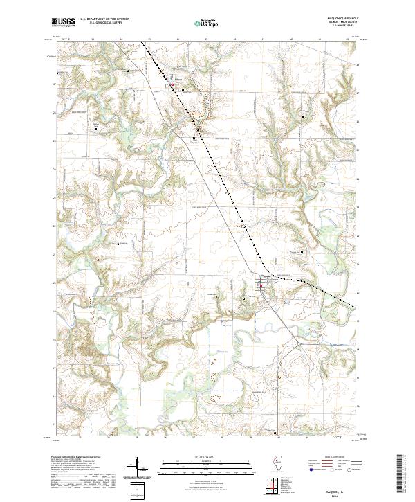
2024 Map of Maquon
USGS Topo · Published 2024About this map
The Spoon River meanders across the southern and eastern reaches of this landscape, carving a valley defined by the winding paths of How Creek, Haw Creek, and Hickory Creek. For genealogists, the density of family-named burial grounds across this rural Illinois terrain is remarkable, preserving the legacy of early farming families through landmarks like Mc Callister Cem, Ferguson Cem, and Thurman Cem.
Find a feature on this map
57 named features on this map. Tap any name to fly to it.
Don’t see what you’re looking for? This feature index may not catch every label — zoom into the map to look around manually.
Map Details
Editions of this 2024 Maquon Map
This is the sole edition of this map. No revisions or reprints were ever made.
Other maps of this area

1912 · Canton
USGS Topo · 1:62,500

1915 · Avon
USGS Topo · 1:62,500

1925 · Galesburg
USGS Topo · 1:62,500

1927 · Galesburg
USGS Topo · 1:62,500

1941 · Maquon
USGS Topo · 1:62,500

1943 · Maquon
USGS Topo · 1:62,500

1944 · Avon
USGS Topo · 1:62,500

1958 · Burlington
USGS Topo · 1:250,000

1961 · Burlington
USGS Topo · 1:250,000

1963 · Burlington
USGS Topo · 1:250,000