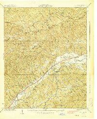
1938 Map of Marble
USGS Topo · Published 1938About this map
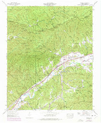
Valley River drainage patterns define this 1938 survey of Cherokee and Graham Counties, where the Southern Railway tracks parallel the water through the valley floor. The industrial character of the era is marked by the Terrazzo Switch near Marble, indicating the local importance of stone extraction and transport. Small rural communities like Tomotla, Coalville, and Woodville are connected by winding roads that transition quickly from the fertile valley bottom to the steep, wooded slopes of the Nantahala National Forest.
Find a feature on this map
92 named features on this map. Tap any name to fly to it.
Don’t see what you’re looking for? This feature index may not catch every label — zoom into the map to look around manually.
Map Details
Editions of this 1938 Marble Map
6 editions found
Other maps of this area

1893 · Murphy
USGS Topo · 1:125,000

1914 · Murphy
USGS Topo · 1:125,000

1927 · Big Junction
USGS Topo · 1:24,000

1933 · Haw Knob
USGS Topo · 1:48,000

1934 · Murphy
USGS Topo · 1:24,000

1934 · McDaniel Bald
USGS Topo · 1:24,000

1934 · Murphy
USGS Topo · 1:48,000

1935 · Peachtree
USGS Topo · 1:24,000

1935 · Robbinsville
USGS Topo · 1:24,000

1935 · Marble
USGS Topo · 1:24,000