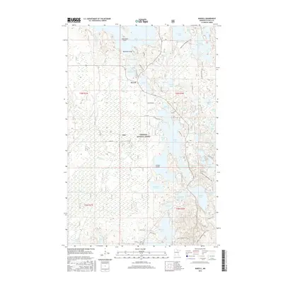
2016 Map of Marcell
USGS Topo · Published 2016About this map
Marcell and Alder serve as the primary hubs in this lake-heavy pocket of the Chippewa National Forest. The landscape is dominated by a complex network of glacial water bodies, from the sprawling Turtle Lake in the north to the distinctive fingers of N Star Lake and Little N Star Lake. This 2016 survey illustrates how modern recreation has integrated into the woods, featuring an extensive system of winter routes including the Marcell N Snowmobile Trail and the Suomi Snowmobile Trail. While much of the land remains forested, local history is rooted in sites like the Suomi Cem near the southern boundary and family-named landmarks such as Jack the Horse Lake and Newburg Bay. The mapping of small tributaries like Potato Cr and the Little Turtle River highlights the delicate drainage patterns that define this Itasca County terrain.
Find a feature on this map
68 named features on this map. Tap any name to fly to it.
Don’t see what you’re looking for? This feature index may not catch every label — zoom into the map to look around manually.
Map Details
Editions of this 2016 Marcell Map
This is the sole edition of this map. No revisions or reprints were ever made.
Other maps of this area

1919 · Marcell
USGS Topo · 1:62,500

1954 · Hibbing
USGS Topo · 1:250,000

1957 · Hibbing
USGS Topo · 1:250,000

1958 · Hibbing
USGS Topo · 1:250,000

1964 · Hibbing
USGS Topo · 1:250,000

1970 · Deer River NE
USGS Topo · 1:24,000

1970 · Wabana Lake
USGS Topo · 1:24,000

1970 · Clubhouse Lake
USGS Topo · 1:24,000

1970 · Jessie Lake
USGS Topo · 1:24,000

1970 · Coon Lake
USGS Topo · 1:24,000