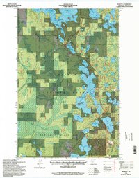
1996 Map of Marcell
USGS Topo · Published 1998About this map
Marcell sits at the heart of this Northwoods landscape, serving as a hub for both administrative and industrial activities within the Chippewa National Forest. The map detail highlights the Marcell Ranger Station and Historic Site, a node of local heritage, alongside a local Sawmill that speaks to the region's timber economy. The terrain is defined by a dense network of glacial water bodies, with the sprawling North Star Lake and Turtle Lake dominating the topography.
Find a feature on this map
52 named features on this map. Tap any name to fly to it.
Don’t see what you’re looking for? This feature index may not catch every label — zoom into the map to look around manually.
Map Details
Editions of this 1996 Marcell Map
This is the sole edition of this map. No revisions or reprints were ever made.
Other maps of this area

1919 · Marcell
USGS Topo · 1:62,500

1954 · Hibbing
USGS Topo · 1:250,000

1957 · Hibbing
USGS Topo · 1:250,000

1958 · Hibbing
USGS Topo · 1:250,000

1964 · Hibbing
USGS Topo · 1:250,000

1970 · Deer River NE
USGS Topo · 1:24,000

1970 · Wabana Lake
USGS Topo · 1:24,000

1970 · Clubhouse Lake
USGS Topo · 1:24,000

1970 · Jessie Lake
USGS Topo · 1:24,000

1970 · Coon Lake
USGS Topo · 1:24,000