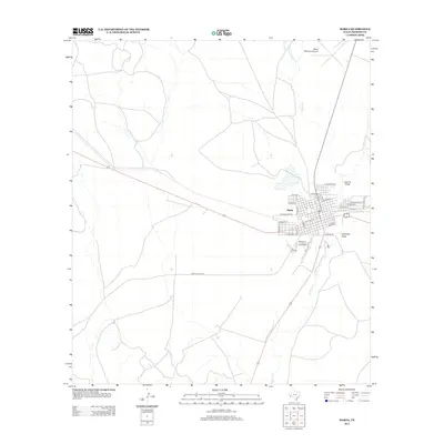
2012 Map of Marfa
USGS Topo · Published 2012About this map
Marfa serves as the central hub for this High Plains landscape, situated at a major crossroads in Presidio County during the early 2010s. The grid system of the settlement is clearly defined, with streets like W Washington St, E Mendias St, and W El Paso St radiating from the core, while Fremont St and E Columbia St provide further local detail. The surrounding terrain is marked by essential drainage features like Cuervo Draw and Greenlee Draw, which channel water toward the S Fork Alamito Cr and the main channel of Alamito Cr.
Find a feature on this map
32 named features on this map. Tap any name to fly to it.
Don’t see what you’re looking for? This feature index may not catch every label — zoom into the map to look around manually.
Map Details
Editions of this 2012 Marfa Map
This is the sole edition of this map. No revisions or reprints were ever made.
Other maps of this area

1895 · Marfa
USGS Topo · 1:125,000

1895 · Alpine
USGS Topo · 1:125,000

1954 · Fort Stockton
USGS Topo · 1:250,000

1958 · Fort Stockton
USGS Topo · 1:250,000

1959 · Marfa
USGS Topo · 1:250,000

1965 · Marfa
USGS Topo · 1:250,000

1972 · Nopal
USGS Topo · 1:24,000
1972 · Mano Prieto Mountain
USGS Topo · 1:24,000

1973 · Fort Stockton
USGS Topo · 1:250,000
1983 · Tinaja
USGS Topo · 1:24,000