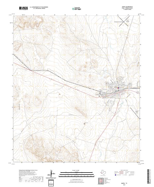
2022 Map of Marfa
USGS Topo · Published 2022About this map
The high plateau of the Trans-Pecos region is home to the town of Marfa, which serves as the focal point for this survey of the High Desert landscape. At the center of the grid-patterned streets stands the Presidio County Courthouse, a prominent landmark in the local government and historical narrative of the county seat. The town is surrounded by a network of ephemeral watercourses including Mimms Draw, Greenlee Draw, and the southward-flowing Alamito Cr.
Find a feature on this map
56 named features on this map. Tap any name to fly to it.
Don’t see what you’re looking for? This feature index may not catch every label — zoom into the map to look around manually.
Map Details
Editions of this 2022 Marfa Map
This is the sole edition of this map. No revisions or reprints were ever made.
Other maps of this area

1895 · Marfa
USGS Topo · 1:125,000

1895 · Alpine
USGS Topo · 1:125,000

1954 · Fort Stockton
USGS Topo · 1:250,000

1958 · Fort Stockton
USGS Topo · 1:250,000

1959 · Marfa
USGS Topo · 1:250,000

1965 · Marfa
USGS Topo · 1:250,000

1972 · Nopal
USGS Topo · 1:24,000
1972 · Mano Prieto Mountain
USGS Topo · 1:24,000

1973 · Fort Stockton
USGS Topo · 1:250,000
1983 · Tinaja
USGS Topo · 1:24,000