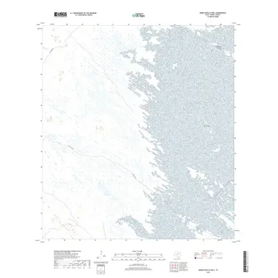
2019 Map of Maria Estella Well
USGS Topo · Published 2019About this map
The coastal wetlands of Kenedy County dominate this 2019 survey, where the intricate transition between land and water defines the South Texas landscape. Small landforms like the Calabazas Islands and Tres Marias emerge from the expansive wet terrain, serving as critical landmarks in an otherwise fluid environment. Navigation through this isolated coastal reach is primarily facilitated by primitive paths such as Gulf Wind Rd and E Turcotte Rd, which cut through the marshy interior. These routes provide essential access for ranching and environmental monitoring in a region where the geography is constantly reshaped by tidal influences and coastal hydrology.
Find a feature on this map
4 named features on this map. Tap any name to fly to it.
Don’t see what you’re looking for? This feature index may not catch every label — zoom into the map to look around manually.
Map Details
Editions of this 2019 Maria Estella Well Map
This is the sole edition of this map. No revisions or reprints were ever made.
Other maps of this area

1923 · Lopena Island
USGS Topo · 1:62,500

1923 · Saltillo Ranch
USGS Topo · 1:62,500

1928 · Sarita
USGS Topo · 1:125,000

1950 · Corpus Christi
USGS Topo · 1:250,000

1951 · Potrero Lopeno NW
USGS Topo · 1:24,000

1952 · Potrero Cortado
USGS Topo · 1:24,000

1952 · Sarita 4 SE
USGS Topo · 1:24,000

1952 · Potrero Lopeno SW
USGS Topo · 1:24,000

1952 · Potrero Lopeno
USGS Topo · 1:62,500

1953 · Brownsville
USGS Topo · 1:250,000