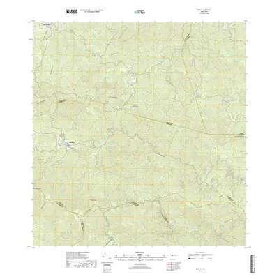
2018 Map of Maricao
USGS Topo · Published 2018About this map
Maricao serves as the central hub in this high-altitude landscape where steep ridgelines and deep river valleys define the interior of the Island of Puerto Rico. This survey details a complex network of waterways, including the Rio Maricao and Rio Bucarabones, that have historically shaped the settlement patterns and agricultural boundaries of the region. Local landmarks like the Cementerio Municipal De Maricao and the high peaks of Pico Montoso and Alto de la Bandera anchor the topography. The map illustrates how municipal lines for Las Marías and Sabana Grande follow the natural divides of the Sierra de Naranjal and the Chuchilla de Bucarabones, revealing the tight relationship between the island's jagged geography and its political borders.
Find a feature on this map
42 named features on this map. Tap any name to fly to it.
Don’t see what you’re looking for? This feature index may not catch every label — zoom into the map to look around manually.
Map Details
Editions of this 2018 Maricao Map
This is the sole edition of this map. No revisions or reprints were ever made.
Other maps of this area

1937 · San German
USGS Topo · 1:25,000

1937 · Sabana Grande
USGS Topo · 1:25,000

1938 · Alto Sano
USGS Topo · 1:20,000

1938 · San Sebastian
USGS Topo · 1:20,000

1941 · San German
USGS Topo · 1:30,000

1941 · San Sebastian
USGS Topo · 1:30,000

1941 · Sabana Grande
USGS Topo · 1:30,000

1941 · Rosario
USGS Topo · 1:30,000

1942 · Central La Plata
USGS Topo · 1:30,000

1942 · Rosario
USGS Topo · 1:30,000