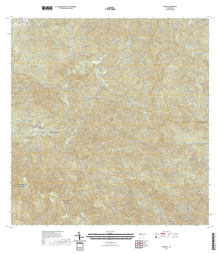
2024 Map of Maricao
USGS Topo · Published 2024About this map
Maricao serves as the central hub for this mountainous region of western Puerto Rico, where the terrain is defined by prominent peaks like Pico Montoso and Pico Santa Ana. The settlement of Pueblo Nuevo sits just east of the main town center, while the Cementerio Municipal De Maricao provides a significant landmark for local history and genealogy research. The landscape is deeply dissected by numerous watercourses, including the Río Maricao and Río Guaba, which flow through the intricate ridges of the Montañas de Uroyan and the Sierra de Naranjal. In the southern reaches, specialized sites such as Campamento Buena Vista and Campamento Santana appear amidst the high-elevation ridges. The network of winding roads, including the Panoramica and PR-120, illustrates the complex geography of the Cordillera Central and its peripheral ranges.
Find a feature on this map
62 named features on this map. Tap any name to fly to it.
Don’t see what you’re looking for? This feature index may not catch every label — zoom into the map to look around manually.
Map Details
Editions of this 2024 Maricao Map
This is the sole edition of this map. No revisions or reprints were ever made.
Other maps of this area

1937 · San German
USGS Topo · 1:25,000

1937 · Sabana Grande
USGS Topo · 1:25,000

1938 · Alto Sano
USGS Topo · 1:20,000

1938 · San Sebastian
USGS Topo · 1:20,000

1941 · San German
USGS Topo · 1:30,000

1941 · San Sebastian
USGS Topo · 1:30,000

1941 · Sabana Grande
USGS Topo · 1:30,000

1941 · Rosario
USGS Topo · 1:30,000

1942 · Central La Plata
USGS Topo · 1:30,000

1942 · Rosario
USGS Topo · 1:30,000