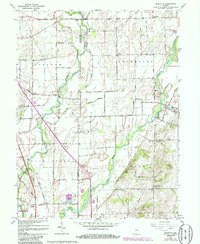
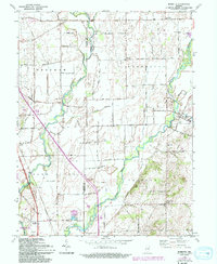
1962 Map of Marietta
USGS Topo · Published 1986About this map
Big Blue River meanders across the landscape of south-central Indiana, defining the geography of eastern Johnson and Shelby counties. This mid-century survey captures a predominantly agricultural region punctuated by quiet hamlets like Bengal, Marietta, and Mt Auburn. The landscape is a network of rural roads such as Shipp Road and Medsker Road, which connect family farms to local centers of community life. Several country churches and burial grounds, including Jollity Ch, Blue River Ch, and the Smiley Cem, serve as critical points for genealogical research. The southern portion of the map is dominated by the Atterbury State Fish and Wildlife Area and a Conrail rail line, showing the intersection of managed natural space and industrial transport. Smaller features like the Township Sch and a local Gravel Pit reflect the self-sustaining nature of these rural townships in the early 1960s.
Find a feature on this map
33 named features on this map. Tap any name to fly to it.
Don’t see what you’re looking for? This feature index may not catch every label — zoom into the map to look around manually.
Map Details
Editions of this 1962 Marietta Map
5 editions found
Other maps of this area

1942 · Franklin
USGS Topo · 1:125,000

1942 · Columbus
USGS Topo · 1:125,000

1947 · Franklin
USGS Topo · 1:62,500

1947 · Hope
USGS Topo · 1:24,000

1948 · Franklin
USGS Topo · 1:24,000

1948 · Edinburg
USGS Topo · 1:24,000

1948 · Hope
USGS Topo · 1:24,000

1948 · Nineveh
USGS Topo · 1:24,000

1948 · Lewis Creek
USGS Topo · 1:24,000

1948 · Marietta
USGS Topo · 1:24,000