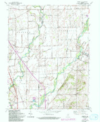
1962 Map of Marietta
USGS Topo · Published 1993About this map
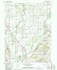
Sugar Creek and the Big Blue River converge in this agricultural region of Central Indiana, defining a landscape of alluvial bottoms and well-defined township boundaries. Small rural centers such as Marietta and Bengal serve as anchors for a grid of named section roads, including 900 South Road and Division Road. The settlement pattern is deeply tied to the waterways, with the Blue River Ch and several burial grounds like Smiley Cem and Brockman Cem situated near the drainage basins. In the southwest, the Atterbury State Fish and Wildlife Area occupies a significant portion of the terrain, featuring specialized infrastructure like a Pumphouse and Water Tank. This 1960s-era revision highlights the transition between traditional farmsteads and modern conservation areas, documenting the precise locations of a Gravel Pit and the Township Sch.
Find a feature on this map
37 named features on this map. Tap any name to fly to it.
Don’t see what you’re looking for? This feature index may not catch every label — zoom into the map to look around manually.
Map Details
Editions of this 1962 Marietta Map
5 editions found
Other maps of this area

1942 · Franklin
USGS Topo · 1:125,000

1942 · Columbus
USGS Topo · 1:125,000

1947 · Franklin
USGS Topo · 1:62,500

1947 · Hope
USGS Topo · 1:24,000

1948 · Franklin
USGS Topo · 1:24,000

1948 · Edinburg
USGS Topo · 1:24,000

1948 · Hope
USGS Topo · 1:24,000

1948 · Nineveh
USGS Topo · 1:24,000

1948 · Lewis Creek
USGS Topo · 1:24,000

1948 · Marietta
USGS Topo · 1:24,000