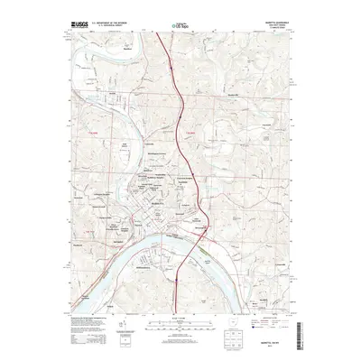
2013 Map of Marietta
USGS Topo · Published 2013About this map
The Muskingum River joins the Ohio River at Marietta, defining a landscape where ancient history and modern industry converge. The presence of the Conus Mound and Mound Cemetery speaks to the deep indigenous history of the site, while the nearby Marietta College and Washington State Community College highlight the area's long-standing role as an educational hub. The river-driven economy is evident through the Muskingum River Lock and Dam Number 3 and several bridges including the Schwendenman Bridge. Residential growth is visible in neighborhoods such as Rathbone Heights, Emerson Heights, and Arlington Heights. Agriculture remains a presence on the periphery, noted by Biehl's Dairy Farm and the Zimmerview Dairy Farm. This map also captures several family-named burial grounds like Kinnaird Cemetery and Lynch Church Cemetery, providing essential landmarks for genealogical research along the valley slopes.
Find a feature on this map
234 named features on this map. Tap any name to fly to it.
Don’t see what you’re looking for? This feature index may not catch every label — zoom into the map to look around manually.
Map Details
Editions of this 2013 Marietta Map
This is the sole edition of this map. No revisions or reprints were ever made.
Other maps of this area

1902 · Parkersburg
USGS Topo · 1:62,500

1903 · Macksburg
USGS Topo · 1:62,500

1904 · Parkersburg
USGS Topo · 1:62,500

1904 · Marietta
USGS Topo · 1:62,500

1905 · Macksburg
USGS Topo · 1:62,500

1909 · Caldwell
USGS Topo · 1:62,500

1912 · Caldwell
USGS Topo · 1:62,500

1924 · Marietta
USGS Topo · 1:62,500

1927 · Marietta
USGS Topo · 1:62,500

1949 · Clarksburg
USGS Topo · 1:250,000