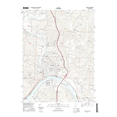
2016 Map of Marietta
USGS Topo · Published 2016About this map
The confluence of the Muskingum River and the Ohio River anchors this regional hub, where the historic city of Marietta sits opposite Williamstown across the state border. This landscape is uniquely defined by its ancient earthworks and commemorative sites, notably the Conus Mound and the adjacent Mound Cemetery. The urban layout reflects its status as an educational and civic center, housing both Marietta College and the Washington State Community College. Northward, the Muskingum valley is dotted with residential developments like Devola and Rathbone, while the rugged hills to the east are carved by Duck Creek and Little Muskingum River. The area’s genealogical record is remarkably dense, featuring numerous burial grounds including Harmar Cemetery, Old Saint Marys Cemetery, and the Lynch Church Cemetery nestled near Stanleyville.
Find a feature on this map
203 named features on this map. Tap any name to fly to it.
Don’t see what you’re looking for? This feature index may not catch every label — zoom into the map to look around manually.
Map Details
Editions of this 2016 Marietta Map
This is the sole edition of this map. No revisions or reprints were ever made.
Other maps of this area

1902 · Parkersburg
USGS Topo · 1:62,500

1903 · Macksburg
USGS Topo · 1:62,500

1904 · Parkersburg
USGS Topo · 1:62,500

1904 · Marietta
USGS Topo · 1:62,500

1905 · Macksburg
USGS Topo · 1:62,500

1909 · Caldwell
USGS Topo · 1:62,500

1912 · Caldwell
USGS Topo · 1:62,500

1924 · Marietta
USGS Topo · 1:62,500

1927 · Marietta
USGS Topo · 1:62,500

1949 · Clarksburg
USGS Topo · 1:250,000