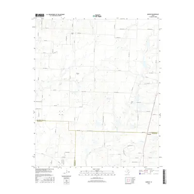
2016 Map of Marilee
USGS Topo · Published 2016About this map
The borderlands of North Texas converge at Marilee, where the boundaries of Grayson, Denton, and Collin Counties meet. This landscape is defined by the headwaters and tributaries of several prominent regional waterways, including Little Elm Cr and its Walnut Fork, as well as Buck Cr and Mustang Cr. The land use is primarily agricultural and rural residential, punctuated by small reservoirs like Hunt Lake Number 1 and Hunt Lake Number 2. Local history and genealogy are anchored by the Gunter Cem and family-named landmarks such as Bridges Field and Mc Manus Field. The road network, including historic routes like Stiff Chapel Rd and Old Tioga Rd, reflects the area's long-standing rural structure as suburban expansion begins to influence the edges of these traditional Texas farm and ranch lands.
Find a feature on this map
74 named features on this map. Tap any name to fly to it.
Don’t see what you’re looking for? This feature index may not catch every label — zoom into the map to look around manually.
Map Details
Editions of this 2016 Marilee Map
This is the sole edition of this map. No revisions or reprints were ever made.
Other maps of this area

1901 · Denison
USGS Topo · 1:125,000

1954 · Sherman
USGS Topo · 1:250,000

1958 · Dorchester
USGS Topo · 1:24,000

1958 · Whitesboro
USGS Topo · 1:62,500

1958 · Sherman
USGS Topo · 1:250,000

1958 · Sherman
USGS Topo · 1:62,500

1960 · Celina
USGS Topo · 1:24,000

1960 · Aubrey
USGS Topo · 1:24,000

1961 · Gunter
USGS Topo · 1:24,000

1961 · Pilot Point
USGS Topo · 1:24,000