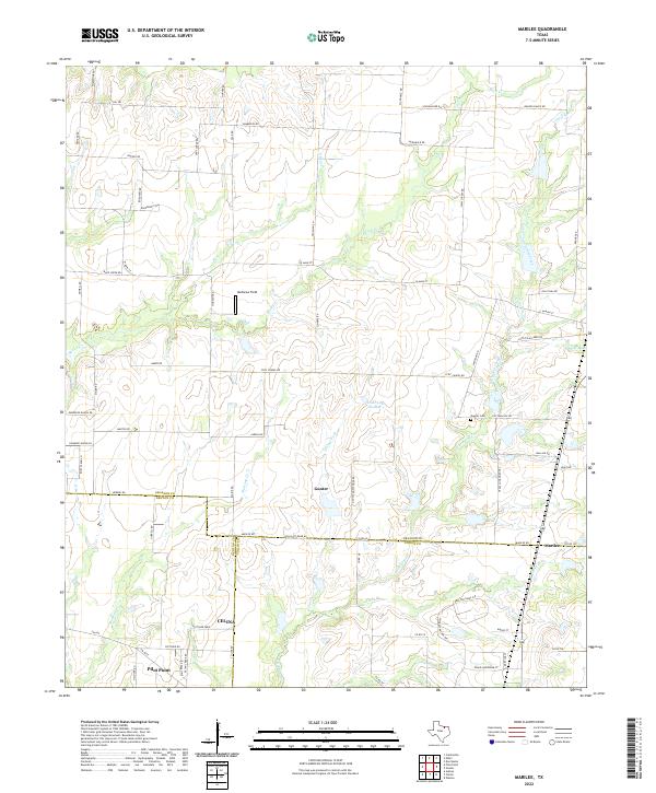
2022 Map of Marilee
USGS Topo · Published 2022About this map
The prairie lands of North Texas converge at the intersection of Grayson, Denton, and Collin counties on this modern topographic record. The small settlement of Gunter serves as the primary hub, where the Gunter Cem and local landmarks like Mcmanus Field sit north of the triple-county boundary line. Waterways such as Walnut Fork and Little Elm Creek carve through the agricultural landscape, feeding into local impoundments like Gunter Lake and Hunt Lake Number 1.
Find a feature on this map
80 named features on this map. Tap any name to fly to it.
Don’t see what you’re looking for? This feature index may not catch every label — zoom into the map to look around manually.
Map Details
Editions of this 2022 Marilee Map
This is the sole edition of this map. No revisions or reprints were ever made.
Other maps of this area

1901 · Denison
USGS Topo · 1:125,000

1954 · Sherman
USGS Topo · 1:250,000

1958 · Dorchester
USGS Topo · 1:24,000

1958 · Whitesboro
USGS Topo · 1:62,500

1958 · Sherman
USGS Topo · 1:250,000

1958 · Sherman
USGS Topo · 1:62,500

1960 · Celina
USGS Topo · 1:24,000

1960 · Aubrey
USGS Topo · 1:24,000

1961 · Gunter
USGS Topo · 1:24,000

1961 · Pilot Point
USGS Topo · 1:24,000