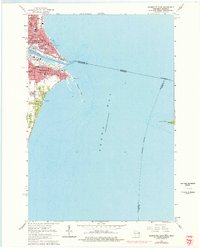
1963 Map of Marinette East
USGS Topo · Published 1977About this map
The Menominee River serves as the focal point for this mid-century survey, dividing the neighboring cities of Menominee, Michigan and Marinette, Wisconsin as they meet Green Bay. The urban landscape is dense with community infrastructure, particularly visible in the numerous parochial and public institutions like Sacred Heart Sch, St Joseph Sch, and the Merryman Sch. Industrial and municipal development is concentrated along the riverbanks, where the C & N W railroad tracks weave through the grid to reach the waterfront.
Find a feature on this map
53 named features on this map. Tap any name to fly to it.
Don’t see what you’re looking for? This feature index may not catch every label — zoom into the map to look around manually.
Map Details
Editions of this 1963 Marinette East Map
2 editions found
Other maps of this area

1939 · Marinette
USGS Topo · 1:48,000

1954 · Escanaba
USGS Topo · 1:250,000

1954 · Manitowoc
USGS Topo · 1:250,000

1957 · Escanaba
USGS Topo · 1:250,000

1958 · Escanaba
USGS Topo · 1:250,000

1958 · Manitowoc
USGS Topo · 1:250,000

1960 · Sturgeon Bay
USGS Topo · 1:62,500

1961 · Little Sturgeon
USGS Topo · 1:62,500

1961 · Chambers Island
USGS Topo · 1:62,500
1963 · Marinette West
USGS Topo · 1:24,000