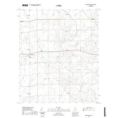
2018 Map of Marion Junction
USGS Topo · Published 2018About this map
Marion Junction serves as the primary hub in this Dallas County landscape, where the rail-aligned settlement patterns of the Alabama Black Belt meet the winding course of the Cahaba River. The area is characterized by numerous family and community landmarks, particularly evident in the concentration of burial sites such as the Rasco Family Cemetery and the Marion Junction Community Cemetery. To the east, the village of Harrell sits along the transit corridor, while the river's path is marked by significant wetlands and oxbow formations like Sherman Pond and Lake Lanier. Evidence of historical river crossings persists in the naming of Moores Ferry Road, which leads toward the water near Milton Branch. This documentation provides a clear view of the rural township structure, including Prosperity Cemetery and Taylor Cemetery, reflecting the deeply rooted genealogical history of this river-valley region.
Find a feature on this map
60 named features on this map. Tap any name to fly to it.
Don’t see what you’re looking for? This feature index may not catch every label — zoom into the map to look around manually.
Map Details
Editions of this 2018 Marion Junction Map
This is the sole edition of this map. No revisions or reprints were ever made.
Other maps of this area

1953 · Montgomery
USGS Topo · 1:250,000

1956 · Montgomery
USGS Topo · 1:250,000

1957 · Montgomery
USGS Topo · 1:250,000

1958 · Selma
USGS Topo · 1:62,500

1958 · Selma
USGS Topo · 1:24,000

1959 · Summerfield
USGS Topo · 1:62,500

1968 · Browns
USGS Topo · 1:24,000

1968 · Safford
USGS Topo · 1:24,000

1975 · Selma NW
USGS Topo · 1:24,000

1975 · Summerfield SW
USGS Topo · 1:24,000