
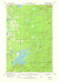
1957 Map of Markham
USGS Topo · Published 1958About this map
The settlement of Markham serves as a lone hub in this mid-century landscape of Northern Minnesota, where the timber and rail economy of St. Louis County is on full display. The Duluth Missabe and Iron Range railroad skirts the northern boundary, while the extensive Whiteface Reservoir dominates the central terrain. This area is heavily defined by its public lands, with the map showing the convergence of the Superior National Forest, Whiteface River State Forest, Cloquet Valley State Forest, and Fairbanks State Forest.
Find a feature on this map
38 named features on this map. Tap any name to fly to it.
Don’t see what you’re looking for? This feature index may not catch every label — zoom into the map to look around manually.
Map Details
Editions of this 1957 Markham Map
2 editions found
Other maps of this area

1949 · Aurora
USGS Topo · 1:24,000

1949 · Allen
USGS Topo · 1:24,000

1950 · Allen
USGS Topo · 1:24,000

1950 · Aurora
USGS Topo · 1:24,000

1950 · Biwabik
USGS Topo · 1:24,000

1951 · Biwabik
USGS Topo · 1:24,000

1951 · Palo
USGS Topo · 1:24,000

1951 · Babbitt SW
USGS Topo · 1:24,000

1951 · Makinen
USGS Topo · 1:24,000

1954 · Two Harbors
USGS Topo · 1:250,000