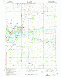
1973 Map of Markle
USGS Topo · Published 1974About this map
The Wabash River flows through the heart of this Huntington and Wells County landscape, creating a distinct riparian corridor that defined local settlement patterns. The town of Markle serves as a primary hub, situated near the Markle State Recreation Area and the critical crossing of the Erie-Lackawanna railroad. This 1973 survey illustrates the agricultural character of the region, where a dense network of drainage systems like Griffin Ditch and Lesh Ditch managed the flat terrain of Union and Rock Creek townships.
Find a feature on this map
35 named features on this map. Tap any name to fly to it.
Don’t see what you’re looking for? This feature index may not catch every label — zoom into the map to look around manually.
Map Details
Editions of this 1973 Markle Map
2 editions found
Other maps of this area

1950 · Warren
USGS Topo · 1:24,000

1952 · Warren
USGS Topo · 1:24,000

1952 · Majenica
USGS Topo · 1:24,000

1953 · Muncie
USGS Topo · 1:250,000

1955 · Markle
USGS Topo · 1:24,000

1956 · Muncie
USGS Topo · 1:250,000

1956 · Huntington
USGS Topo · 1:24,000
1961 · Zanesville
USGS Topo · 1:24,000

1962 · Uniondale
USGS Topo · 1:24,000

1962 · Ossian
USGS Topo · 1:24,000