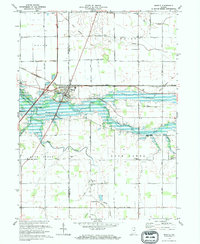
1973 Map of Markle
USGS Topo · Published 1974About this map
Markle serves as the central hub of this 1970s landscape, situated along the Wabash River where the Huntington and Wells County line divides the terrain. The map captures a complex water management system featuring the broad Wabash River Lake and numerous drainage channels such as Griffin Ditch and Elkenberry Ditch. A diagonal Indian Treaty Boundary cuts across the northern rural sections, overlaying the modern grid of township roads.
Find a feature on this map
33 named features on this map. Tap any name to fly to it.
Don’t see what you’re looking for? This feature index may not catch every label — zoom into the map to look around manually.
Map Details
Editions of this 1973 Markle Map
2 editions found
Other maps of this area

1950 · Warren
USGS Topo · 1:24,000

1952 · Warren
USGS Topo · 1:24,000

1952 · Majenica
USGS Topo · 1:24,000

1953 · Muncie
USGS Topo · 1:250,000

1955 · Markle
USGS Topo · 1:24,000

1956 · Muncie
USGS Topo · 1:250,000

1956 · Huntington
USGS Topo · 1:24,000
1961 · Zanesville
USGS Topo · 1:24,000

1962 · Uniondale
USGS Topo · 1:24,000

1962 · Ossian
USGS Topo · 1:24,000