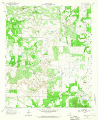
1964 Map of Markley
USGS Topo · Published 1967About this map
The rural landscape of the Young and Jack County border is defined by a series of intermittent waterways and petroleum development in the mid-1960s. Markley sits in the north, while the southern edge of the sheet is anchored by Jermyn, situated along an Old Railroad Grade that once connected the region's scattered agricultural and oil communities. The terrain transitions from the low-lying basins of Brushy Creek and Plum Creek toward more prominent features like Rattlesnake Mountain and Bare Mountain to the west. Industrial activity is concentrated within Wilton Field and various oil fields, where multiple wells and drill holes are mapped. Local history and genealogy are preserved through landmarks such as Plum Grove Ch and Graceland Cem, which reflect the small, established settlements that persisted even as the railroad lines fell into disuse.
Find a feature on this map
16 named features on this map. Tap any name to fly to it.
Don’t see what you’re looking for? This feature index may not catch every label — zoom into the map to look around manually.
Map Details
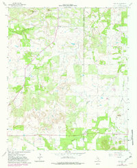
Editions of this 1964 Markley Map
2 editions found
Other maps of this area

1927 · Graham
USGS Topo · 1:62,500

1954 · Wichita Falls
USGS Topo · 1:250,000

1958 · Wichita Falls
USGS Topo · 1:250,000

1962 · Antelope Creek NE
USGS Topo · 1:24,000

1964 · Senate
USGS Topo · 1:24,000

1964 · Darnell Branch
USGS Topo · 1:24,000

1964 · Loving
USGS Topo · 1:24,000

1964 · Bryson
USGS Topo · 1:24,000

1964 · Lake Eddleman
USGS Topo · 1:24,000

1964 · Lynn Creek
USGS Topo · 1:24,000