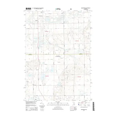
2014 Map of Marlborough
USGS Topo · Published 2014About this map
The Pere Marquette River system dominates this landscape of the northern Lower Peninsula, where the river's middle and south branches converge within the Manistee National Forest. Small communities like Marlborough, Lilley, and Bitely are clustered along the corridor of State Hwy 37, which serves as the primary north-south artery through the forested terrain. The map reveals a high density of glacial kettle lakes, including the substantial Pettibone Lake and Lilley Lake, many of which are ringed by local roads such as Aster Rd and Honeysuckle Dr. Local history is anchored by sites like Oaklawn Cem near the Lake County line and the Lilley Cem further south. The presence of the Baldwin Municipal Airport in the northern section indicates the area's role as a regional hub for aviation and recreational access.
Find a feature on this map
78 named features on this map. Tap any name to fly to it.
Don’t see what you’re looking for? This feature index may not catch every label — zoom into the map to look around manually.
Map Details
Editions of this 2014 Marlborough Map
This is the sole edition of this map. No revisions or reprints were ever made.
Other maps of this area

1931 · Baldwin NW
USGS Topo · 1:31,680

1931 · Baldwin NE
USGS Topo · 1:31,680

1932 · Chase NW
USGS Topo · 1:31,680

1954 · Midland
USGS Topo · 1:250,000

1958 · Midland
USGS Topo · 1:250,000

1958 · Woodville
USGS Topo · 1:62,500

1959 · Midland
USGS Topo · 1:250,000

1959 · Reed City
USGS Topo · 1:62,500

1959 · Baldwin
USGS Topo · 1:62,500

1959 · White Cloud
USGS Topo · 1:62,500