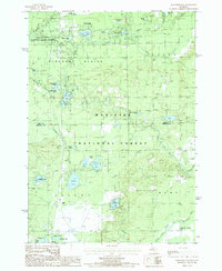
1987 Map of Marlborough
USGS Topo · Published 1987About this map
Marlborough sits at the northern edge of this Lake and Newaygo County landscape, where the Baldwin River and Pere Marquette River converge. The terrain is defined by a dense concentration of glacial kettle lakes, ranging from the prominent Pettibone Lake and Lilley Lake to smaller named bodies like South Lake and Houseman Lake. This late-1980s data records a mix of outdoor recreation and local infrastructure, featuring the Baldwin Municipal Airport and a Drive-In Theater near the river forks.
Find a feature on this map
45 named features on this map. Tap any name to fly to it.
Don’t see what you’re looking for? This feature index may not catch every label — zoom into the map to look around manually.
Map Details
Editions of this 1987 Marlborough Map
This is the sole edition of this map. No revisions or reprints were ever made.
Other maps of this area

1931 · Baldwin NW
USGS Topo · 1:31,680

1931 · Baldwin NE
USGS Topo · 1:31,680

1932 · Chase NW
USGS Topo · 1:31,680

1954 · Midland
USGS Topo · 1:250,000

1958 · Midland
USGS Topo · 1:250,000

1958 · Woodville
USGS Topo · 1:62,500

1959 · Midland
USGS Topo · 1:250,000

1959 · Reed City
USGS Topo · 1:62,500

1959 · Baldwin
USGS Topo · 1:62,500

1959 · White Cloud
USGS Topo · 1:62,500