1955 Map of Marlette Lake
USGS Topo · Published 1964About this map
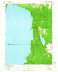
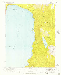
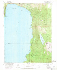
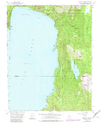
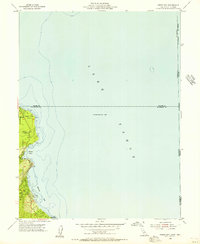
Lake Tahoe's eastern shoreline dominates this mid-century survey, revealing a landscape defined by water management and forest service presence. High above the Crystal Bay waters, the map meticulously charts the Marlette Lake and Marlette Reservoir system, including a prominent Flume and the Marlette Creek drainage. This water infrastructure was vital for supporting downstream communities and early industry in the Nevada hills.
Find a feature on this map
33 named features on this map. Tap any name to fly to it.
Don’t see what you’re looking for? This feature index may not catch every label — zoom into the map to look around manually.
Map Details
Editions of this 1955 Marlette Lake Map
4 editions found
Other maps of this area

1891 · Carson
USGS Topo · 1:125,000

1891 · Truckee
USGS Topo · 1:125,000

1893 · Carson
USGS Topo · 1:125,000

1893 · Truckee
USGS Topo · 1:125,000

1895 · Truckee
USGS Topo · 1:125,000

1932 · Truckee
USGS Topo · 1:96,000

1940 · Truckee
USGS Topo · 1:125,000

1950 · Mt. Rose
USGS Topo · 1:62,500

1952 · Mt. Rose
USGS Topo · 1:62,500
1955 · Meeks Bay
USGS Topo · 1:24,000