
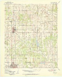
1951 Map of Marlow
USGS Topo · Published 1951About this map
Marlow and the northern reaches of Duncan anchor this mid-century portrait of Stephens County, where the historic path of the Chisholm Trail and the Old Chisholm Trail intersect with the modern industrial landscape. The survey details a region defined by the Chicago Rock Island and Pacific railroad and an emerging energy sector, evidenced by numerous oil wells and the Radio Sta KRDH.
Find a feature on this map
33 named features on this map. Tap any name to fly to it.
Don’t see what you’re looking for? This feature index may not catch every label — zoom into the map to look around manually.
Map Details
Editions of this 1951 Marlow Map
2 editions found
Other maps of this area

1901 · Addington
USGS Topo · 1:125,000

1902 · Rush Springs
USGS Topo · 1:125,000

1949 · Cement
USGS Topo · 1:62,500

1949 · Nellie
USGS Topo · 1:62,500

1949 · Rush Springs
USGS Topo · 1:62,500

1950 · Rush Springs
USGS Topo · 1:62,500

1950 · Marlow
USGS Topo · 1:62,500

1955 · Lawton
USGS Topo · 1:250,000
1956 · Rocky Ford
USGS Topo · 1:24,000
1956 · Denton
USGS Topo · 1:24,000