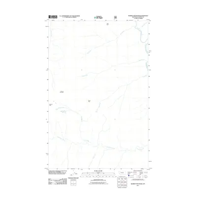
2011 Map of Marmot Mountain
USGS Topo · Published 2011About this map
The South Fork Flathead River carves through the eastern edge of this wilderness terrain, defining a landscape shaped by narrow drainages and high summits. Reaching elevations marked by Marmot Mountain, Stadium Peak, and Snow Peak, the area is characterized by its complex network of cold-water tributaries. Small, secluded water bodies like Recluse Lake sit high in the drainage basins, while prominent geological features such as Slick Rock overlook the winding paths of Slick Creek and Hungry Creek. This portion of Flathead County illustrates the natural hydrology of the region before further human development, with names like Little Salmon Creek and Chasm Creek tracing the deep seasonal runoff channels that feed the larger river system to the east.
Find a feature on this map
14 named features on this map. Tap any name to fly to it.
Don’t see what you’re looking for? This feature index may not catch every label — zoom into the map to look around manually.
Map Details
Editions of this 2011 Marmot Mountain Map
This is the sole edition of this map. No revisions or reprints were ever made.
Other maps of this area

1936 · Silvertip
USGS Topo · 1:96,000

1942 · Silvertip
USGS Topo · 1:125,000

1955 · Choteau
USGS Topo · 1:250,000

1957 · Choteau
USGS Topo · 1:250,000

1958 · Choteau
USGS Topo · 1:250,000

1962 · Choteau
USGS Topo · 1:250,000

1965 · Sunburst Lake
USGS Topo · 1:24,000
1965 · String Creek
USGS Topo · 1:24,000
1965 · Holland Peak
USGS Topo · 1:24,000

1970 · Big Salmon Lake East
USGS Topo · 1:24,000