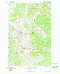
1965 Map of Holland Peak
USGS Topo · Published 1968About this map
Holland Peak stands as the centerpiece of this mid-1960s survey, marking a high point along the boundary between Flathead Co and Missoula Co. The landscape is dominated by the protected expanses of the Flathead National Forest and the Bob Marshall Wilderness, where the terrain is defined by a dense network of high-altitude water bodies including Sappho Lake, Rumble Creek Lake, and the Terrace Lakes.
Find a feature on this map
34 named features on this map. Tap any name to fly to it.
Don’t see what you’re looking for? This feature index may not catch every label — zoom into the map to look around manually.
Map Details
Editions of this 1965 Holland Peak Map
2 editions found
Other maps of this area

1902 · Ovando
USGS Topo · 1:125,000

1905 · Ovando
USGS Topo · 1:125,000

1921 · Elbow Lake
USGS Topo · 1:125,000

1936 · Silvertip
USGS Topo · 1:96,000

1942 · Silvertip
USGS Topo · 1:125,000

1955 · Choteau
USGS Topo · 1:250,000

1957 · Choteau
USGS Topo · 1:250,000

1958 · Choteau
USGS Topo · 1:250,000

1962 · Choteau
USGS Topo · 1:250,000

1965 · Condon
USGS Topo · 1:24,000