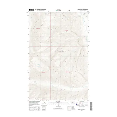
2014 Map of Marmot Mountain
USGS Topo · Published 2014About this map
Flathead National Forest land defines the interior of this quadrangle, where the steep topography of the Rocky Mountains creates a complex network of high-elevation drainages. High points such as Marmot Mtn and Snow Peak overlook deep valleys where water moves through Chasm Cr and Snow Cr toward the South Fork Flathead River in the northeast corner. This environment is punctuated by isolated water bodies like Recluse Lake and Picture Lake, the latter situated near the prominence of Picture Ridge.
Find a feature on this map
25 named features on this map. Tap any name to fly to it.
Don’t see what you’re looking for? This feature index may not catch every label — zoom into the map to look around manually.
Map Details
Editions of this 2014 Marmot Mountain Map
This is the sole edition of this map. No revisions or reprints were ever made.
Other maps of this area

1936 · Silvertip
USGS Topo · 1:96,000

1942 · Silvertip
USGS Topo · 1:125,000

1955 · Choteau
USGS Topo · 1:250,000

1957 · Choteau
USGS Topo · 1:250,000

1958 · Choteau
USGS Topo · 1:250,000

1962 · Choteau
USGS Topo · 1:250,000

1965 · Sunburst Lake
USGS Topo · 1:24,000
1965 · String Creek
USGS Topo · 1:24,000
1965 · Holland Peak
USGS Topo · 1:24,000

1970 · Big Salmon Lake East
USGS Topo · 1:24,000