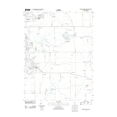
2012 Map of Marquette Heights
USGS Topo · Published 2012About this map
Marquette Heights and the surrounding suburban expanses of North Pekin and Pekin Heights are depicted here during a period of established residential growth east of the Illinois River. The landscape is characterized by a high density of rural and institutional burial grounds, such as the Zion Evangelical United Brethren Cem and the Tazewell County Farm Cem, providing valuable touchpoints for genealogical research. While the northern and western sections are defined by modern subdivisions and thoroughfares like LaSalle Blvd, the eastern reaches near Groveland maintain a agricultural character, evidenced by the Maple Lawn Jersey Farm. The terrain is etched by the meandering courses of Lick Cr and Lost Cr, which Feed several small water bodies including Grand Oaks Lake and Lutticken Lake. This survey illustrates the transition from traditional farming to late-century residential development in Tazewell County.
Find a feature on this map
148 named features on this map. Tap any name to fly to it.
Don’t see what you’re looking for? This feature index may not catch every label — zoom into the map to look around manually.
Map Details
Editions of this 2012 Marquette Heights Map
This is the sole edition of this map. No revisions or reprints were ever made.
Other maps of this area

1905 · Peoria
USGS Topo · 1:62,500

1927 · Peoria
USGS Topo · 1:62,500

1928 · Mackinaw
USGS Topo · 1:62,500

1932 · Mackinaw
USGS Topo · 1:62,500

1942 · Delavan
USGS Topo · 1:62,500

1949 · Peoria East
USGS Topo · 1:24,000

1949 · Peoria West
USGS Topo · 1:24,000

1950 · Peoria West
USGS Topo · 1:24,000
1950 · Peoria East
USGS Topo · 1:24,000

1951 · Minier
USGS Topo · 1:62,500