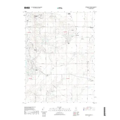
2018 Map of Marquette Heights
USGS Topo · Published 2018About this map
Pekin and its neighboring communities of Marquette Heights and North Pekin define this landscape east of the Illinois River. The map captures a high density of local heritage sites, particularly cemeteries that serve as vital links for genealogical research. Notable among these are the Zion Evangelical United Brethren Cem and the Evangelical Mennonite Cem, reflecting the area's religious history. The drainage of Lick Creek and Dillon Cr shapes the topography, creating space for numerous residential developments centered around small water bodies like Lake Wahalo, Lake Wildwood, and the Lake of the Whispering-Oaks. The presence of the Tazewell County Farm Cem near Tremont provides a specific look at the county's historical social infrastructure during this era of 21st-century suburban and agricultural balance.
Find a feature on this map
141 named features on this map. Tap any name to fly to it.
Don’t see what you’re looking for? This feature index may not catch every label — zoom into the map to look around manually.
Map Details
Editions of this 2018 Marquette Heights Map
This is the sole edition of this map. No revisions or reprints were ever made.
Other maps of this area

1905 · Peoria
USGS Topo · 1:62,500

1927 · Peoria
USGS Topo · 1:62,500

1928 · Mackinaw
USGS Topo · 1:62,500

1932 · Mackinaw
USGS Topo · 1:62,500

1942 · Delavan
USGS Topo · 1:62,500

1949 · Peoria East
USGS Topo · 1:24,000

1949 · Peoria West
USGS Topo · 1:24,000

1950 · Peoria West
USGS Topo · 1:24,000
1950 · Peoria East
USGS Topo · 1:24,000

1951 · Minier
USGS Topo · 1:62,500