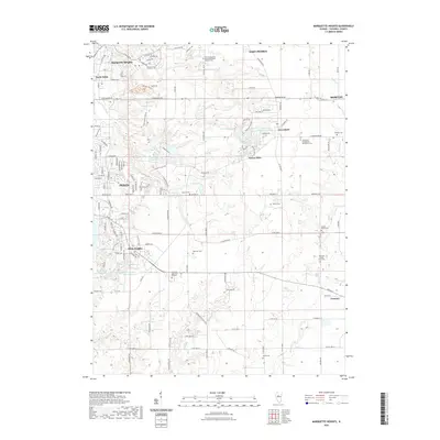
2021 Map of Marquette Heights
USGS Topo · Published 2021About this map
Marquette Heights and the suburban reaches of Pekin define this section of Tazewell County, where residential development meets the agricultural tradition of the Illinois prairie. The landscape is marked by numerous family and community burial grounds, including the Railroad Cem and the Tazewell County Farm Cem, which offer significant touchpoints for local genealogists. Water features such as Birkey Lake, Lake Wildwood, and the Lake of the Whispering Oaks are integrated into the community layouts, while Lick Creek and Dillon Creek provide natural drainage through the undulating terrain.
Find a feature on this map
136 named features on this map. Tap any name to fly to it.
Don’t see what you’re looking for? This feature index may not catch every label — zoom into the map to look around manually.
Map Details
Editions of this 2021 Marquette Heights Map
This is the sole edition of this map. No revisions or reprints were ever made.
Other maps of this area

1905 · Peoria
USGS Topo · 1:62,500

1927 · Peoria
USGS Topo · 1:62,500

1928 · Mackinaw
USGS Topo · 1:62,500

1932 · Mackinaw
USGS Topo · 1:62,500

1942 · Delavan
USGS Topo · 1:62,500

1949 · Peoria East
USGS Topo · 1:24,000

1949 · Peoria West
USGS Topo · 1:24,000

1950 · Peoria West
USGS Topo · 1:24,000
1950 · Peoria East
USGS Topo · 1:24,000

1951 · Minier
USGS Topo · 1:62,500