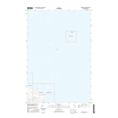
2017 Map of Marquette NW
USGS Topo · Published 2017About this map
Granite Island sits isolated in the expanse of Lake Superior on this 2017 survey of the Upper Peninsula shoreline. The map focuses primarily on the northern reaches of Marquette County where the coastline meets the water at Little Granite Point Presque Isle. Inland, the landscape is defined by the drainage of Harlow Cr into Harlow Lake, a significant water body situated just south of the lakefront. This area is characterized by its recreational and transit infrastructure, including the N Country National Scenic Trail which winds through the southern portion of the quadrangle. Transportation is limited to a few key corridors such as Co RD 550 and Harlow Lake Rd, indicating a sparsely populated region primarily utilized for its natural shoreline and forest trails.
Find a feature on this map
11 named features on this map. Tap any name to fly to it.
Don’t see what you’re looking for? This feature index may not catch every label — zoom into the map to look around manually.
Map Details
Editions of this 2017 Marquette NW Map
This is the sole edition of this map. No revisions or reprints were ever made.
Other maps of this area

1907 · Marquette
USGS Topo · 1:62,500

1953 · Marquette NW
USGS Topo · 1:24,000

1953 · Negaunee
USGS Topo · 1:24,000
1954 · Marquette
USGS Topo · 1:24,000

1954 · Negaunee
USGS Topo · 1:62,500

1954 · Big Bay
USGS Topo · 1:62,500

1954 · Marquette
USGS Topo · 1:62,500

1958 · Marquette
USGS Topo · 1:250,000

1960 · Marquette
USGS Topo · 1:250,000

1961 · Marquette
USGS Topo · 1:250,000