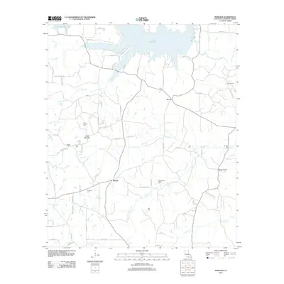
2012 Map of Marsalis
USGS Topo · Published 2012About this map
Lake Claiborne dominates the northern reaches of this Claiborne Parish landscape, with the Lake Claiborne St Park providing a structured recreational anchor along the shoreline. The terrain south of the water is a network of rural communities including Marsalis, Aycock, Point Pleasant, and Tulip. This area is characterized by a mix of agricultural land and timber, punctuated by the industrial presence of the Lisbon Oil Field and the Sugar Creek Oil and Gas Field.
Find a feature on this map
72 named features on this map. Tap any name to fly to it.
Don’t see what you’re looking for? This feature index may not catch every label — zoom into the map to look around manually.
Map Details
Editions of this 2012 Marsalis Map
This is the sole edition of this map. No revisions or reprints were ever made.
Other maps of this area

1949 · Gibsland
USGS Topo · 1:62,500

1950 · Gibsland
USGS Topo · 1:62,500

1950 · Arcadia
USGS Topo · 1:62,500

1951 · Arcadia
USGS Topo · 1:62,500

1951 · Summerfield
USGS Topo · 1:62,500

1952 · Homer
USGS Topo · 1:62,500

1955 · Shreveport
USGS Topo · 1:250,000

1956 · Shreveport
USGS Topo · 1:250,000

1984 · Shreveport
USGS Topo · 1:250,000

1985 · Monroe North
USGS Topo · 1:100,000